Africa Lobbying for a new world map: Here’s why how Africa wants to redraw the world map
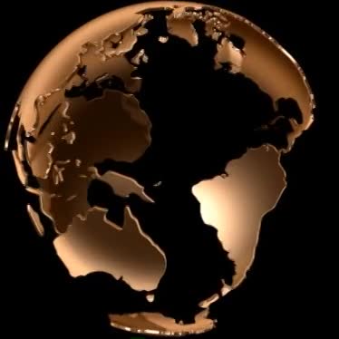
For centuries the standard world map used in schools, offices and pretty much everywhere has been the Mercator projection, a centuries-old map style from the age of sail, still prevails in the internet age. Just in case you didn’t know, it was drawn that way to be easily used for navigation particularly in the sea so generally some of the countries were distorted and their sizes magnified or reduced in size. For example Africa seems like a small continent but the truth is USA, China, South America and most of western Europe can fit into Africa and still leave some space. Relevant African bodies are pushing for the correction of this centuries old misinformation and introduce a map that truly reflect the true sizes of continents and countries. So Here’s what the African Union wants to use instead.
In 1569, Flemish mapmaker Gerardus Mercator synthesized existing ideas in navigation and cartography to create a new type of world map. It has stood the test of time: Billions of people would recognize it today, from their classroom walls and navigation apps.
Crisscrossed by rail-straight lines that correspond to constant compass bearings, the Mercator projection was ideal for navigation in the age of sail, at the expense of showing the actual size of landmasses: The farther from the equator they are, the larger they appear.
Greenland might look the same size as Africa (rather than some 14 times smaller, as in reality), but at least an adventurous crew could sail from one to the other without constantly recalculating their course.
The projection is just as useful, it turns out, for zoomable web maps, which work seamlessly over its simple grid system. But its longevity has come at a cost, critics argue.The African Union earlier this month joined a campaign calling for the replacement of the Mercator projection with maps that show Africa’s accurate size.Select a projection
“Maps shape how we remember and understand the world,” said cartographer Tom Patterson, a creator of the Equal Earth map, which the African Union has endorsed in the Mercator’s place. “The kind of misrepresentation in Mercator’s projections can deeply influence how people see the world, and in misleading ways.”
Such critiques, which have long simmered among cartography nerds and in decolonization discourse, have gained new traction thanks in part to Correct the Map, a campaign now backed by the African Union, with the weight of its 55 member states.
The Dutch and English used the Mercator projection to map their growing empires, said Matthew Edney, director of the History of Cartography Project and a professor of cartography at the University of Southern Maine. The Mercator remains inextricably bound up in that history.
“The weight of the map is thoroughly tied to the connotation it has to marine power, navigation and the support it provided to imperial sentiments,” he said.While Greenland and Africa’s apparent similar size is the most widely cited example of Mercator distortion, many areas, especially in the north, are stretched drastically. The United Kingdom appears to be almost three times as large as it is. And North America appears over four times its actual size.
“Even in the 19th century and before, there were grumblings about the way the Mercator distorts,” Edney said. “But maybe because no one body was in charge or publishers already had printing plates prepared and they didn’t want to make new efforts, or because people liked how you could make the projection fit any size, it stayed relevant.”
The demand to use different projections is political. “It might seem to be just a map, but in reality, it is not,” Selma Malika Haddadi, the African Union Commission’s deputy chair, told Reuters. The idea is to turn away from a colonial-era map that critics say has diminished Africa’s importance in the popular imagination. The Mercator misrepresented Africa as “marginal,” Haddadi said, when in fact it is the world’s second-largest continent, with more than 1 billion people. The AU did not respond to requests for comment on its map policies.
While the criticism is gaining steam, the Mercator’s simplicity and usefulness have earned it many defenders. “European civilisation is guilty of centuries of crimes against the global south, but the Mercator projection is not one of them,” one letter-writer to the Guardian argued. Since all projections are flawed, best to simply use a globe, another wrote.
The AU-endorsed Correct the Map campaign, led by advocacy groups Africa No Filter and Speak Up Africa, favors the adoption of the 2018 Equal Earth map, created by Patterson and his colleagues. Like the Mercator, it is optimized in one area at the expense of another: While the Equal Earth map shows the true relative sizes of landmasses, their shapes are distorted.
No map projection is perfect — it is impossible to fit the spherical globe onto a two-dimensional surface without compromises, Patterson said.
“Maps can be equal area, conformal like the Mercator or equidistant, which means all distances are equal as you radiate out from a vector point,” Patterson said. “You can’t have more than two properties in any flat map. And the Equal Earth map only has only one of these.”

Before the Equal Earth map, there was the Gall-Peters projection, which is an equal-area map, but it does not retain the familiar shapes of continents, and there was the Robinson projection, which was visually attractive but not equal area, Patterson said.Patterson and his colleagues aimed to create a map that was pleasing to the eye and displayed the continents without size distortion, he said.
“The African Union’s endorsement is a historic milestone,” said Fara Ndiaye, co-founder of Speak Up Africa. “It transforms our cultural demand into a political one.”Ndiaye said that the AU was using the Mercator projection on its websites, but that her organization was working with the bloc to change them. The campaign has called on numerous international organizations to replace their maps.
On Google Maps desktop, users can choose between Mercator and globe view, said Caroline Bourdeau, a spokeswoman for the company. On mobile, Google Maps only offers Mercator.
The World Bank uses the Winkel tripel or the Equal Earth projections on its static maps, and its internal maps use the Robinson projection, not the Mercator, according to a statement sent by email.
“While some other mapping apps still using the Mercator projection, we are replacing them with Equal Earth,” the statement said. “The World Bank Group is committed to ensuring accurate representation of all people, on all platforms.”
The U.S. Geological Survey uses the Web Mercator projection for its basemap services the background layers of information for building maps. The Mercator remains industry standard for web mapping because of its ability to preserve angles and shapes, said Jason Burton, a spokesperson for the USGS, adding that it is working on upgrading its basemaps to eventually allow users to apply custom projections with minimal distortion.
Moving away from the Mercator projection would change how the world understands Africa, and how Africans understand their own continent, Ndiaye said.
“It means children in Africa (and across the world) opening a textbook and seeing their continent represented at its true scale,” she said. “Maps are not neutral. They were never meant to be. It shapes how we learn, how we imagine power, how we see ourselves.” Credit WP.
It remains to be seen if this would change so but we will update you.
If you have a tip, a story, or something you want us to cover get in touch with us by clicking here. Sign up to our newsletter so you won’t miss a post and stay in the loop and updated also we will be launching a free basic cybersecurity short course for beginners to teach you how to protect yourself online. Just subscribe for free to our newsletter and create an account on perusee to be eligible.
Note: You can also advertise on Perusee, just contact us, call or app +263 78 613 9635
Click here to Follow our WhatsApp channel
Keep comments respectful and inline with the article, also create an account and login to chat with members in our forum, get help on issues you need help with from community members.